Wednesday, 8 December 2021

Rathmell -1 Dec 2021 Walk for the Climate - Rathmell History

It's the first day of the month: = Walk for the Climate Day

We use prayers from "Pray and Fast for the Climate" website - It is just a month since COP26.

We -   a group from Churches Together in Settle and District, and from Craven Conservation Group.

we

  • Explore
  • Learn new things about nature and how our world works
  • Get exercise, fresh air and friendship 
  • Pick litter
  • Listen
  • Become more aware


OK - today?

The walk today is great for 

Learning about Rathmell's varied Christian and Village Heritage - up to the present day

Following an old hedged bridleway - with singing nuthatch, long-tailed tits and ferns

Seeing goats and alpacas

Crossing a bridge into the conifer forest - over a foaming white torrent 

Distant views of Long Preston Deeps, Penyghent and Ingleborough

A welcome cup of coffee at the village Reading Room - kept open and warm and with laptop electricity  for villagers who are now into the fourth day with no electricity after storm Arwen on Friday

Meeting a Rathmell resident enthusiastic about Lichens - After reading Martin Sheldrake's book!


Let's leave the village car park and set off.


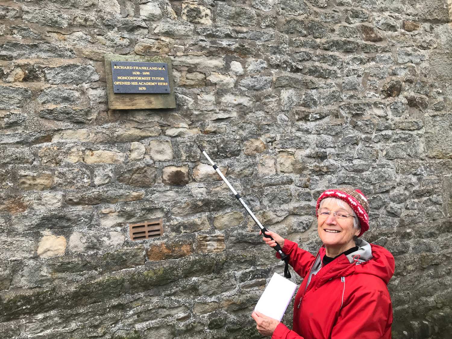
1. Rathmell Academy - 

The oldest "dissenters college" in the north of England.

This is on the main road, straight opposite the village car park at the north end of the village. You can see the 17th C lintels above the windows.

Richard Frankland of Rathmell founded it in 1670. In 1662 priests had to swear allegiance to accept certain Church of England principles, and if they did not do this they could no longer be priests. They lost their jobs; they could not get a good education in established colleges. So dissenters colleges were set up. Richard Frankland ran it here for about 4 years then moved it to various places - first Natland near Kendal, later to Calton (near Airton) and elsewhere and then came back here again.

You can tell this row of cottages is old by the lintels above the window - but it is helpful that there is now a plaque on the wall on the main road.


100m south along the main road is Rathmell C of E Church


2. Rathmell C of E Church.


They are busy preparing for a Christmas Tree festival inside.

Stephen Dawson climbs over Christmas tree decoration packaging boxes to write down our visit in the visitors book - 1 Dec -remember the date!!


By the 4th Dec it is transformed


I remember Clarice Howorth (nee Garnet)'s funeral
here several year's ago. It was packed with old students from Wesley Girl's High School, Ghana (The best girl's secondary School in Ghana) where Clarice used to be Headmistress.
They had come, some by train and some 40 on a bus on a very snowy day in February 2013


Clarice Garnet is the artist who designed out Craven Conservation Group logo


Back to 1 Dec, and another 100m along the road


3. Rathmell Methodist Chapel. 

This has the church inside and a small meeting room and loo. The congregation here is now very small.  It includes John Harrison who I used to see at Age UK events at Settle St Johns. (Now stopped at St John's since COVID)


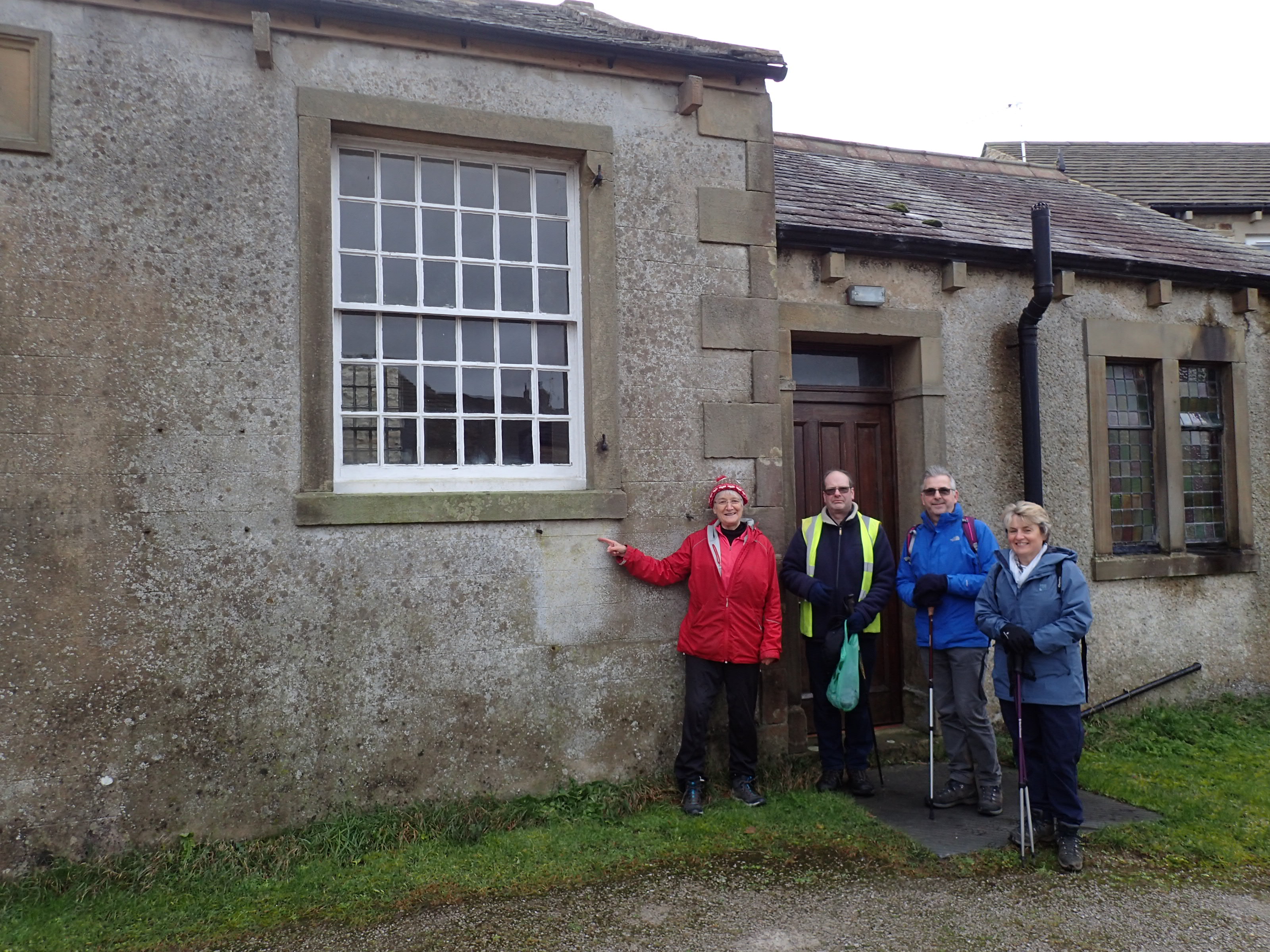
This is us outside Rathmell Chapel


After another 100m we turn right.

An ash tree that was blown down in storm Arwen.

I point to the annual rings.

The famous naturalist and scientist John Ray (1627 –  1705)  was one of the first people to write about dendrochronology - aging a tree by its rings. He was from Essex but visited Settle on two occasions when collecting plants.


Back Lane becomes a bridle way, bordered by hedges with ferns. .. And after the recent rain, puddles.

Most of the land round here is pasture land, bordered by stone walls. Not rich in wildlife. So it is delightful to walk aling here

Candle-snuff fungus on a log by the path

Back in c 1985 Clarice had arranged for Craven Conservation Group and the Yorkshire Dales Conservation Volunteers with Russ Turner and Allan Laing (I think) to open up some of Back Lane - so I am pleased to walk along it today.


We come out at Mill Glen and say Hello to one of the  alpacas 


Then we pass though a plantation bordering Rathmell Beck


This is the highest point of our journey.

The field has had its rushes cut.  Behind us you can see - starting a mile away the area covered by SD86 - My lichen survey. - including Cleatop Park Wood.


Back through the plantation

Then down the road past Rathmell Okd School


To the village hall. - to be continued..


Saturday, 30 October 2021

CaminotoCOP pilgrimage Newton - Bentham 6 Oct - Glasgow 3O Oct

I joined the Camino to COP pilgrims as they walked the 16 miles from Newton in Bowland over the moor of the Forest of Bowland to High Bentham. This day the central part of their route - indeed they were less than 10 miles from the centre of gravity of Britain.

We had splendid weather and views.

We had a tight schedule as the BBC had arranged to interview some of the key walkers when we came to The Great Stone of Four Stones at Bentham at 4pm and they came back with us to the Methodist Church at Bentham where the pilgrims were staying over night

I am told the pilgrims will feature on Sunday Live on BBC1 on 31 October

The first mile


The pilgrims had a coat and at each stage new squares were added to it created by people of that area.  New pilgrims were encouraged to wear it for sections of the journey and they had a special song to sing.


 Lower down I will link to the video of my wearing it and Tim Fox of Bentham wearing it.

I have written more about the day on Green Christian's website  


At Croasdale Farm we had an excellent introduction to farming in the Forest of Bowland by farmer  Malcolm Handley and an opportunity ask questions - managing the land to retain carbon, to have some biodiversity. He has schools and apprentices to visit and do tasks. - 


At the summit, at lunch one pilgrim gave a powerful rendition of the song St Patrick's Breastplate (Christ be with me..)


Some biodiversity en route


Caterpillar -- yet to be named

Meadow waxcaps and other waxcaps

Hawthorn


The Great Stone of Four Stones


Looking down from the Great Stone


The light was fading as we reached Bentham two miles beyond.. a welcome supper had been prepared for the pilgrims at the Methodist Church by people from the Anglican Church and others... And the pilgrims could look forward to sleeping on a floor with underfloor heating!


SD86 - 28 - SD8268 - Stainforth How Beck - Lichens

Please Come back in two days when I have added pictures.

--------------------------------
Day 1: How Beck 

Monad SD8268 does not look too prepossessing or exciting - At first sight is has NO trees - though careful searching does eventually reveal three small patches of trees. 
There are no buildings - not a single barn which might support old mortar! Much of the land is covered with rush pasture or unimproved pasture

I plan to follow How Beck.  This cuts through Silurian and Ordovician  siliceous rock  (like you find in the Lake district and North Wales) - So it might reveal some good lichens. 

How Beck is not a famous stream. 

It is only 1 km 1ong

But it ascends 125 m or 410 ft in that 1 km 
 - almost 1/5 height of Penyghent. or  
1 1/2 times the height of Malham Cove
or 1/4 of the height difference between the river and the summit of Penyghent

- in fact c 120m /400ft within the central 1/2 km.

The lowest 200m of the stream is  buried under the main road and railway and flat last field as it exits into the Ribble at 202m

I discover the path beside it is part of the Ribble Way

I discover the path beside it is also part of the A Pennine Journey trail

Well Well. Perhaps someone will do a search for one of these Long distance Paths and end up on this post .. if so - Welcome

Welcome - enjoy learning a little about the lichens

The Ribble Way makes a detour at Stainforth and leaves the Ribble and follows the How Beck up to Moorhead Lane at 347 m, and then turns left along the Moorhead Lane down and to Helwith Bridge and the Ribble again.

The original path continues up the ridge between the valleys on either side on what is essentially the south west spur of Penyghentm right to the summit of Penyghent 
5km away:

And the A Pennine Journey follows a track parallel to this path till the paths join up and follow the flat and mostly peaty ridge all the way up to the summit of Penyghent 

To the east is Silverdale which after Dalehead becomes Penyghent Gill (The valley pass between Stainforth and Halton Gill at the top of Littondale which joins Wharfedale.) To the west is the main Ribble Valley.

As the stream makes its steep descent it cuts through Silurian and Ordovician rocks. These are siliceous rocks - as found in the Lake District and Wales - and they can support different lichens to millstone grit and sandstone - the main other types of acid rock round here.

I had discovered good lichens on the rocks on the lower part of this beck earlier - in SD8167 (and the top corner of SD 8267 looks as though it has potential) with Dog lichen in the  shallow turf- Peltigera hymenina .   On the vertical faces of rocks near the stream were Varicellaria lactea and Lecanora rupicola and Xanthoparmelia conspersa


I walk up through the two and a half fields from Stainforth - up and up, over the Anglian lynchets (ridges)

The first day (15 Oct) I look at two very small areas: 

Area 1 : The 20 square m or  on the rocks beside the stream

Area 2:  200m further up the patch in the 3 sq m of wall at the stile -

In area 1   I play my tin whistle beside the stream and take photos of the valley below - right as far as Pendle Hill in the distance.

I notice a hiker with a huge rucksack climbing the footpath. the Ribble Way - I never catch him but I do proceed to Area 2 - the dry stone wall which has a mixture of rocks

 The two areas together reveal 34 different species of lichen.

"This will give me an orange dot to put on my map." I calculate. (over 19 is yellow, over 29, orange, over 41 brown over 56 red) "But if I can record another 7 species, that will get it up to 41, and I can change it to an brown dot"

All the species I have found are typical of acid rock, with half a dozen extra that are growing on some limestone in the wall.

Over the wall in the distance I can see a dozen or rather scrappy willow trees, growing amongst the newly planted tree guarded saplings. "Ah they are sure to have the common pollution tolerant lichens that grow on nearly every tree. I will come back and record them another time."

           --------------------------------------------

Day 2:

Thursday 21 Oct is another sunny day. - How Beck and How Beck Plantation

I set off rather late - after 3pm, and tack my way up the steep field with its lynchets, picking up waxcaps as I stagger up.

Revisiting the stream edge,  I find a two new lichens - but I do not know their names. Huh .What use is that!! Plus a Collema (Black Jelly Lichen) that I put in a bag.

So up to the field with the trees. Here I find the five lichens I was expecting plus a couple of sprigs of Ramalina fastigiata.   the Physcia tenella has a pink lichenicolous fungus on it which turns out to be Ilosporiensis christianensis

In 15 years time when all the young saplings in this field have grown there will be several more lichens.

In the evening I look at the Collema - I have to key it out.

It is Collema flaccidum - Whey! - I took a video of that at Kirkstone Pass last month. A new record for the Hectad. I hope.

I enter the lichens on my spreadsheet. 41 species total. Yes. I can mark that monad as brown, not orange. It is now the fourth most diverse monad out of the 28 monads I have so far attempted.  Not bad for 2 and a half visits.

But the number of habitats left to explore is low.

there is more stream running through the marshy plantation. There are another lm or 2 of wall. But there are no more big trees, no limestone bedrock, no buildings with mortar. Just lots of grass and rushes. 

    -------------------------------------------------

Friday evening 22nd. 

I get out the specimens I had brought back and copydexed some onto card and worked out what three more are.

Now at 44 species it is the third equal most highly scoring monad out of the 28 monads I have recorded.

Wed 26th

I show photos of some of my unknown species to the BLS "Lichen Chat and Improvement Group" - with abject apologies that there is no scale on the photo nor K or C test.

It is suggested that this one growing on siliceous rock right next to the stream (which I had though looked like a Dermatocarpon) might be Dermatocarpon  meiophyllizum . 

I look at the distribution map and see it has been recorded in the stream below the Norber erratics i.e. similar rock and height.

No luck with suggestions for the other species.


-------------------------------------------------

Day 3: Thursday 28th Oct: Goat Lane

I have been indoors a few days, I need some fresh air.. even if the thick grey clouds make everywhere look very dark at even 10.am So on Thursday morning I drive through Stainforth and up the road (towards Halton Gill) labelled Goat Lane on the OS map, half a mile until I am just inside SD8268 - this time at the SE corner of the monad.

Trees!. Several mature Beech, over the wall to the south plus  a couple of hawthorn, ash, sycamore and elder beside the road to the north..

I look at the trees/bushes to the norht. I can now add Ramalina farinosa and Phlyctis argena to my list. Surely this Hawthorn tree can produce a Ramalina fraxinea - It is exposed and high up in a similar place to where I have seenothers. No.

The wall is an excellent habitat to study. If I bend down I can shelter from the wind.

The wall is old and the slate fragmenting - I can take specimens simply by putting my fingernail in the slate.

I put my head up above the parapet/ wall - whoo it is still windy. I bend down again and add more common lichens of acid walls to my list - Cladonia pyxidata, Ochrolechia parella (I think) 

I find a small place  where mortar (old fashioned mortar" has been put into the wall ) "Yes" - Verrucaria muralis - I take a photo, retreat to the Car and descend to civilisation. and shelter from the wind

--------

Five new species. That brings my total to 50! - and is the second highest Total (My winning total is 62 from Huntworth Common)

I need to get another 6 species for my dot to turn red at 56. Well that is  not impossible!


---------------------------

Day 4: Fri 29 Oct. Goat Lane Waterfall

I really must sort the specimens I brought back yesterday.

But by 3.30pm I see bright sunlight between the showers.. perhaps goat Lane will be brighter today and reveal more species - O set off at 4pm (far too late..) and drive up Goat Lane, to the same parking place.

I have noticed it says "waterfall" on the map - at the line between SD8268 and SD8267. So I walk up to the boundary and look at the wall and stream at and just north of the waterfall. 

This is at the same height - 300m - as my How Beck site. This stream does not have a name on the map. Let's call it Goat Lane Waterfall stream now. Later I look across the pasture and note the old deep tracks and ditches and holloways winding their way up the hill - The past efforts to make a road up such a steep hill - before the current road was eventually walled and then tarmacked. People could not just nip up in their car. 


Day 5: Goat Lane on foot - Thur 4 November

I am lacking exercise and it is a pleasant afternoon so I go for a walk /jog (oh my knees) stroll to Goat Lane - It is just over 3km there and 3 km back - total >6km of 4 miles.


but I don't have a camera. The sun is getting very low and the wall is perpendicular to the sun so neither side gets sunlight. I discover that the tiny bit of mortar I had seen in the wall on my last trip was not mortar, but concrete, and it did not have any Verrucaria muralis in it. at all. I picked up a possible different Cladonia. I took a sample of a lichen form the bark of a sycamore (?) tree in the north side of the road.


Day 6: Sun 6 November - Mature trees - adjacent and south of Goat Lane 

It is not windy or rainy - just mildly sunny and mildly damp. I will drive up to Goat Lane again.

I go through the gate into the field south/down from the road whihc have half a dozen mature beech trees and 1 mature ash (dying) and 1 mature lime.

My excurssion into the field is rewarded:

Ramalina fastigiata (1 peice) - on Ash

Candelaria concolor one piece on Ash

Lecanora expallens - on Beech - I think I had also brought that back from rock from the wall below it last time.


the beech trunks have a lot on them - Ramalina farinacea, Hypotrachyna afrorevoluta L expallens, Parmela saxatilis, a little Arthonia radiata.

There was an interesting fungus in the soil but coming from the Beech root


Saturday, 2 October 2021

Walk and Pray for the Climate: 1 October - Ribblehead Sphagna; Fungi and Drovers Road at Thorns


 This walk features

  • Sphagna
  • Fungi
  • History and Dales Architecture - Drove road, Packhorse bridge, Deserted hamlet of Thorns
  • Prayers for the Climate
  • ..and Cake..

It is a "First day of the month with climate prayers walk" organised by Churches Together in Settle and District jointly with Craven Conservation Group. This is the twelfth walk!!. We started last November

Although starting officially at Ribblehead (and if you wanted to repeat this walk you can get there by train)  ours starts unofficially at Horton in Ribblesdale Macmillan Coffee Morning. Chance to meet others, and stock up with cake for packed lunch.


Replenishments


I drive to Ribblehead.. and find
Sphagnum palustre (green and branches tapering)
 and Sphagnum capillifolium (red)

 (I place the pictures of the other five Sphagna at the end)


Doris arrives (as a train trundles its way across the viaduct to Carlisle)


We assemble  near the "wind turbine/mill" half a mile east of Ribblehead. 

It is very exposed and very windy. Bracing I would say.. within a minute or so the lens gets spotted with raindrops.


But is  only a brief attempt at a shower. The sun stays out.

Father Stephen collects litter


We collect .. Breakfast!  Agaricus sp.

The following are NOT edible 

Cystoderma amianthinum

A species of Stropharia I suggest (Poisonous)


Stropharia seen from below


A brilliant time to cross the packhorse bridge . - Now decorated by red rowan berries and red hawthorn berries

Three days ago the stream would probably have  have been empty

We stay a while in the shelter of the the gorge, sheltered from the wind above.


We cross the drovers road. This was once the main road up the valley. After the heavy rain yesterday, a stream now runs down the "road"


We sit downm sheltered from the wind by a farm wall.


And eat lunch.. Tastes even more delicious here than in the coffee morning.

Once dances were held here.. 


Artistic picture through two "windows"


We set off again up the old road


Father Stephen takes a photo looking back to Thorns


I take a photo from higher up.  There are so many places I recognise in this picture: Straight behind the roof is Ashes Pasture (the orangish bank) where we went for our climate walk in July. If you know the area you will recognise more places.


As we return up towards the Hawes road we see the new farm building near Gearstones - 21st century farm buildings!


Then 1/3 mile back along the road to the wind turbine and our cars. (Yes cars.. If only I could have said one a half miles back to the train..  to have been really green we would have come by train to Ribblehead. Maybe another time.. Still it's only 11 miles to Settle. 

  (For the record this is in the week of the "Panic induced petrol/diesel crisis in the filling stations..")


So the rest of the Sphagna: 


Sphagnum papillosum has stumpier branches than palustre.
(both papillosum and palustre really need checking microscopically)


Heath Lousewort


Sphagnum cuspidatum   Drowned Cat Sphagnum - the pool is rather to deep today to see it well.

Sphagnum fallax

Only 20 percent of Britain's bogs are in good condition - i.e. wet enough for lots of Sphagna to grow, rather than drying out and the peat being blown away or washed away.  The peat in the flat areas here had some reasonable Sphaga (OK, not as good as further west in the Lake District where they get more rain, but still a nice variety.)

Over the road to the south on the banks there are some flushes where water comes out of the ground.

Breutelia chrysocoma, Shagnum subnitens (the red one) and a version of Cows-horn Sphagnum - need to check which one.

More of it


Judith shows one of the cards she sells for the Rainforest Fund-
This card features Ribblehead Viaduct