Skip to here at the second half of the post with pictures of us on 1st Feb
This post is in three parts::
1. Geology and rather rambly introduction.
2. My preparatory walks with pictures - the first third of a mile.
3. The actual walk with the people on 1 Feb.
1. Geology and rather rambly introduction
Come with me as I explore the beginning of the route for "The first of the month walk for Feb 2022" which will take place on Tue 1 Feb.
This is a local walk - Meet 2pm at Giggleswick Vicarage BD24 0AP on Tue 1 Feb. I will be co-leading this for Craven Conservation Group and Churches Together in Settle. (And any others interested)
I set off to investigate it twice in this week before the official walk - and by the end of the second visit I have only made to to field number 3, one third of a mile away. This post explains why -
The geology and landforms of the area are fascinating.
Limestone to the north east
Giggleswick vicarage is at the foot of Belle Hell (road), at the foot of The Mains (road), at the foot of Lord's Wood - All this land is limestone and jagged limestone rocks can be seen above Lord's Wood to the north.
Glacial Lake
The lower part of Giggleswick is built on, or round the flat land that is the remains of a glacial lake that stretches from the Bridge at Long Preston up through the area know as Long Preston Deeps, up to here. . And on alluvial material left by rivers coming into the lake. Maybe that is why the Giggleswick and Village Playing fields have not been built on. Villages were built on the higher land: the valley floor, even after the lake had gone, would have been very boggy and liable to flooding. (Note the positions of Rathmell and Long Preston on higher land above the valley). Some drainage may have started in the late 1750s, (The fens were drained in the late 17th century) Much agricultural field drainage with tile pipes took place at the end of the 19th C.( 12 million acres of land was drained between 1840 and 1890)
lkm away to the south east, and in the next 1km square, is Swaw Beck, and what I call Swaw Beck Lane, beside Swaw Beck - obviously straightened and deepened to maintain the drainage in this area.. This very straight, very flat lane, with scattered trees beside the Beck, has a "lowland feel". It is a dead end, as it is now replaced by the By-pass, so there is no traffic on it.. I had fun exploring Swaw Beck road in November 2020 in the same monad: SD8063 -and I got the lichen score up to 55, my highest for a monad (1km square). Now I am exploring a different habitat in the adjacent monad, where so far I have only found 27 species, on a walk from near Giggleswick station to Close House in 2019. Perhaps I can find yet more species. Either way it is good to explore a new path.
South Craven Fault
Some where at the bottom of Belle Hill, Maybe below the vicarage itself, is the South Craven Fault.
Because as we climb the hill on the west side of the valley we find ourselves on gritstone.
This is Brennand (or Grassington) Grit on top of Pendleton Grit -
more on this as we explore the route.
2. My preparatory walks with pictures - the first third of a mile
What do I see en route?
Our footpath is parallel to the steep road (Craven Bank Lane) that leads up to the chapel, but it is 200m south of it. Leaving the road at SD81036386.
Tuesday 25th afternoon is cloudy. The first 200 metres is a walled track
that leaves Raines Road a little way south of the car park at the corner at the Giggleswick Grammar School, and runs behind Castleberg Hospital.
That track takes us into SD8063.
There are lichens on the old mortared wall on the left - White patches with black white rimmed fruiting bodies - possibly Tephromela atra a new species for SD 8063
On Thursday below - the sun keeps coming out
 |
| This is the flower of the grass. |
Actually I did once find it beside the Settle Carlisle Railway line in SD8162 in the 1990s - the same tetrad in fact. BSBI map for distribution of B pinnatum
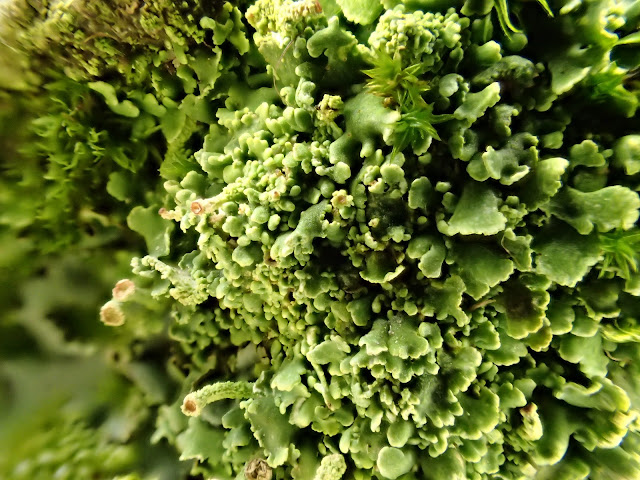
There are several species of Cladonia or Pixie-cups on the wall top here. I follow the wall round the perimeter of the field looking at lichens till I get to the stile at the top - I take photos of the area - very atmospheric with the low cloud.
 |
| This Cladonia has red fruiting bodies |
 |
| View from near stile looking across to Lord's Wood |
 |
| Hypogymnia physodes - the thallus lobes are swollen. the tips of the lobes bend back and have soredia |
 |
| Opegrapha gyrocarpa - Orangy-pinky-brown mosaic lichen on vertical surfaces of acid rock. |
 |
| "Nuisance Alga" - Klebsormidium crenulatum covers areas of wall (stifling lichen growth here) - an indication of |
 |
| Klebsormidium is a filamentous alga - almost like velvet. |
Next Attempt: Thursday 27th.
Thursday afternoon is sunny. Parking is tough here on a Thursday afternoon, with the car park full and parking cones laid out on the road to prevent dangerous street parking. I resort to parking quite a place quite a distance from the route start.
Off up the walled track again, over the first stile and up to the top stile. but first I'll have a look at the oak tree north of the top stile
 |
Oak twigs are easily recognisable in winter because the brown buds are not opposite and they are clustered near the tips of the twigs I was telling a friend that I had read/ heard recently that only a small percentage of British people can actually recognise oak leaves, so I took picture of a leaf lying on the ground. We learned songs at school like "The oak and the ash and the bony ivy tree.." and there are many folk song versions of it . but how many people can recognise oak and ash? Can you? I is a simple leaf with a wavy, a lobed edge.  My friend then told me he could recognise and oak leaf because it is the symbol of the National Trust. I thought for quite a while "Where can I find an oak tree in Settle to show people?" Do you know of any? - It is difficult. Oak trees rarely grow on limestone. Most trees on limestone are Ash or Sycamore. There is a tiny oak tree that has just been planted in Giggleswick churchyard - but that is planted. But now on this slope of boulder clay with underlying gritstone rock it is a good place for oak to grow |
 |
| Near the base is a Cladonia species |
 |
| There are two lichens here - the grey leafy lichen with no powdery soralia or lumpy isidia on the surface.. And one with tiny black dots on a pinkish grey thallus |
 |
| This crustose lichen has fine yellowish greenish powder on the central part of its surface. It is Lecanora expallens |
 |
| More tiny black dots |
 |
| This lumpy one needs identifying - then I can add it to my list |
 |
| Lecanora muralis on the lower steps of the stile. This is the only Lecanora that is lobate at the margin of the thallus |
 |
| A runner runs up the hill. I ask him to take a photo whilst I pose... |
Both the stile and these rocks are at 170m above sea level - and the start of the path was 140m and the flat land in the distance). 30m is not a huge height is it? - but it feels like I have clmbed a mini mountain.
 |
| occasional patches of Xanthoparmelia conspersa and |
 |
| Parmelia omphalodes and |
 |
| This picture measures 2 to 3 sm across |
 |
| The same one - the above picture is about 1cm across |
With the light fading.. I decide to return home.
Look forward to seeing you on Tuesday the 1st Feb.!! 2pm the Vicarage BD24 0AP
yy----------------------------------------------------------yy
The Walk takes place: this section written on/after 1 Feb:
We meet at the vicarage, walk round to Raines Road and sett off up the hill.
 |
| Entering the first field (this is now the third picture now of this view!) |
 |
| The Oak tree at the top of the field |
 |
| View from the oak tree .. in the wind... |
 |
| In the next tiny fieldlet is a Magical Ash tree. |
 |
| Below the above mentioned outcrop |
 |
| Two fields further and we approach another very rounded rocky outcrop |
 |
| In the next field is a lovely big alder. |
 |
| Some big boulders have been built into the wall. |
 |
| This one has Xanthoparmelia conspersa - what I was calling "Creme de menthe" lichen, after its colour but have been reminded at this week's BLS Lichen Zoom meeting it should be "Eau de Nil" |
 |
| We walk through the buildings of Close House - it really is a hamlet!. Several of the buildings are Grade 2 Listed buildings. I think the one ahead looks Georgian |
 |
| An old footpath sign points back to Close House |
 |
| Zoom in and we see the A65 bypass and the railway line that we walked under |
 |
| We walk down the road towards Shaw Farm/Swaw Farm - taking care as we pass mature trees, especially the ash, as gusts of wind to 50mph keep blowing past. |
 |
| It has simple rhizines -roots that look like spikes, possibly like dogs teeth. It has some dark veins underneath, but white in between,. It has isidia - frilly bits round the edge of the thallus. |
 |
| Near Gildersleets |
 |
| Sally and I visit the Fishermen's bench - and see the plaque to Derek Soames (who did a lot at St John's Church Settle, and also for the Railway Line) |
 |
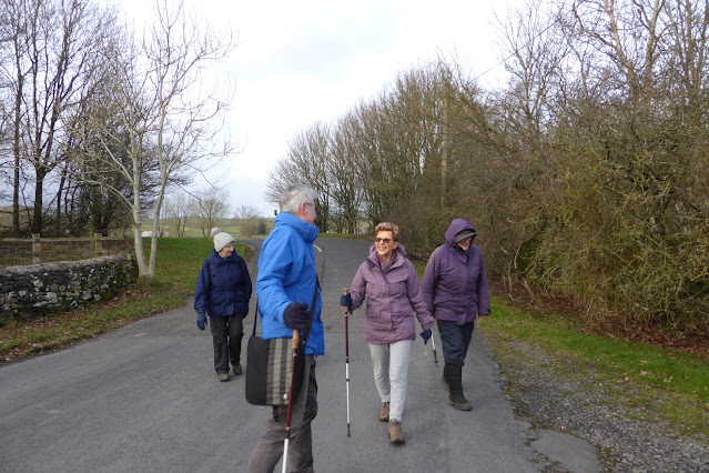
| The others who did not visit Derek's seat have shot off ahead. We are route marching back now. |
 |
| We'll soon catch them. Oohh my feet. |
I hope you will join us next month - Same day of the week again, because February has 28 Days.


No comments:
Post a Comment